SubTel Forum Interactive Cable Map Released
SubTel Forum Press Release
July 24, 2019
SubTel Forum’s Submarine Cables of the World Interactive Map is now live.

With data powered by the extensive STF Analytics Submarine Cable Database, this new online map was built with the industry-standard Esri ArcGIS platform and aims to put as much publicly available data in the users’ hands as possible.
“This has been a long time in the making,” said Wayne Nielsen, President of Submarine Telecoms Forum. “We’ve taken a collection of our publications from throughout the year, the Submarine Cable Almanac and Wall Map, and wrapped them into a slick and powerful analytical tool updated in live time.”
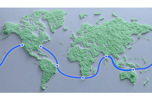
This map is a visual and interactive tool featuring some 290 current and planned cable systems, over 750 landing points as well as per capita mobile subscription and internet accessibility data for 254 countries.
“The objective of this map is to not only inform and educate the industry but also become a collaborative data collection and validation aid for systems’ data,” said Nielsen.
Each system entry is linked to the SubTel Forum News Now Feed. For the first time, the published news history of each system will be at the user’s fingertips, creating an irreplaceable reference tool for industry professionals.
As with every publication supported by the STF Analytics Submarine Cable Database, the data represented is made possible through the extensive research of the analysts at SubTel Forum and from the continued support of industry contributors.
“We believe that an informed industry is a productive one and continuing with the spirit of other SubTel Forum publications, the new online map aims to raise the bar on information accessibility,” said Nielsen.
As with all SubTel Forum publications, data collection is sourced through publicly available information. If you see a system that needs to be updated, or have an inside scoop, please use any of the convenient links on the Map’s page to suggest an update.
news via inbox
Sign up to get the latest updates straight to your inbox!